Sicily and Sardinia are roughly comparable in area and also share certain problems related to their insular character. On the whole, however, one is struck by the contrasts rather than by the similarities. In the first place, Sicily is separated from the mainland (il continente to Sicilians) by the narrow Strait of Messina. This is crossed by a frequent ferry service carrying both goods and passenger trains and synchronised with train services in Calabria; through sleeping coaches run from many distant towns on the mainland to Palermo and Catania.
Electricity is also now carried across the Strait from Calabria. Sardinia’s link with the mainland is altogether more tenuous. Secondly, Sicily has 31½ times more people than Sardinia. Thirdly, the agriculture of Sicily is more diversified, with an important production of citrus fruits, wine and other Mediterranean crops for sale outside the island; it also has a rapidly expanding oil industry, in contrast to the declining coal industry of Sardinia.
In many respects Sicily reproduces the features already described in the South: a long period of drought in the summer, a crystalline massif (in the north-east), an active volcano, broken Tertiary hill country in the interior, fertile coastal lowlands. There are however no proper structural basins in the interior, while sandstones, marls and clays are much more widespread than limestones.
In the north-east the Nebrodi and Peloritani mountains are a continuation of the Calabrian crystalline massifs and exceed 1,500 metres in places, forming a barrier behind the northfacing Val Demone. To the south the great cone of Etna, 3,263 metres at its highest, dominates the landscape, being visible on a clear day from many points on the island and in Calabria, and from far out at sea. Elsewhere there are no such prominent mountains but rather a number of isolated mountain areas (750-1,500 metres) such as the Monti Sicani and Monti Iblei, separated by lower but still relatively rugged hill country, the general level descending towards the southfacing coast of the island. The largest lowland occurs in the east, the Piana di Catania.
Along the north coast, and the east coast as far as Catania, there is a mountain-backed Riviera-like landscape. Along the south coast hill country reaches to the sea in many places leaving only modest-sized lowlands. Only 25% of Sicily is classified as mountain, but 61% is hill country and 14% plain.
With steep slopes, fertile soils the exception, most of the land of mediocre quality, and with very hot dry conditions throughout the summer, Sicily is not the flourishing garden of the Mediterranean it is so often said to be; its cereal yields are among the lowest in Italy and lack of fodder in the summer greatly restricts livestock carrying capacity. Most of the interior and the southern coastlands of the island have an economy based on wheat cultivation supplemented by olives, beans and carobs. Specialised tree crop cultivation is largely restricted to the east and north coastlands and the extreme west.
The hydro-electric potential is very limited and Sicily depends on power from Calabria and on thermal electricity. Output from its famous sulphur deposits has declined in recent decades, but some mines are being revived by modernisation. On the other hand, the extraction of oil in the south-east has made great progress lately. Industrially, Sicily comes very low among the regioni of Italy. Metallurgical, engineering and textile industries are virtually non-existent, but, as in Apulia and Campania, food processing is well represented, while recently progress has been made in developing chemicals. There are plans to build a steelworks in Palermo.
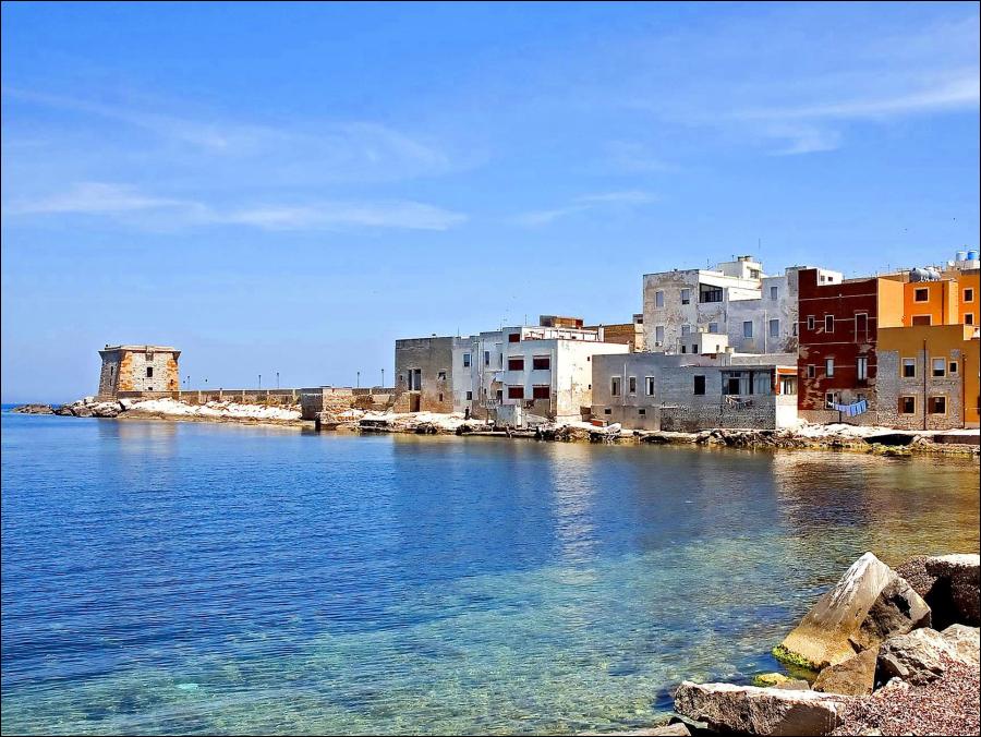
The most densely populated part of Sicily extends from Marsala and Trapani in the west, in a narrow strip along the north and east coasts as far as Syracuse. There is a dense, partly dispersed, rural population along this strip, which also contains the six largest towns on the island. These coastlands account for almost all the agricultural products sold elsewhere. High grade wines are prepared in the west, and citrus fruits are grown in the Conca d’Oro behind Palermo, all along the north coast and on the south-eastern, lower slopes of Etna as well as in the Piana di Catania.
In the interior, agriculture is less on a commercial basis; large nucleated hilltop centres, very urban in appearance, dominate the settlement pattern, and farm labourers often walk several kilometres to the land they work. There is a limited surplus of wheat and other foodstuffs from the interior, but this presumably goes to make up the deficit in the areas of specialised agriculture and in the larger towns.
Over 30% of the population is in the six largest towns, an excessive concentration of population in places of this size, given the predominantly agricultural nature of the economy. In the west, Trapani and Marsala are centres of the wine industry as well as being small ports. Palermo, the largest town in the island and sixth in Italy, is the capital of Sicily and regional centre for the western half of the island. It is an attractive town, in spite of its large areas of slum tenements, and has a wonderful setting, but, like Naples, its great size is not justified economically.
Messina like Palermo has very little industry. Though almost completely destroyed by an earthquake fifty years ago, it has been rebuilt and has grown to a considerable size. Between Messina and Taormina is the principal resort coast of Sicily, Taormina and Acireale being favourite centres. Etna itself is used for winter sports. Catania, the regional centre for the eastern part of Sicily, is another impressive city with mainly service functions, the regional centre for the eastern part of the island. Syracuse, on the other hand, has come to life since the Second World War thanks to the development of industry in the south-east of Sicily. At Augusta, 12 miles to the north, is one of Italy’s largest oil refineries and a large chemicals complex. In the vicinity of Ragusa over 2m tons of oil are now produced. Gela is the site of the latest project, a large petrochemicals plant based on local oil.
In the interior of Sicily life continues at a slower pace. Enna and Caltanissetta are high province capitals, stagnating service centres with much unemployment and few prospects of change in the immediate future. Some improvements have been made in the vicinity of Agrigento, however, thanks to the revival of sulphur mining and the exploitation of potash deposits, and the trade of Porto Empedocle is growing fast. The easiest lines of movement across the island to the Strait of Messina are along the north and east coasts and only difficult railways with steep gradients penetrate the interior. The area immediately south of Palermo remains the most backward part of the island, still stifled economically and socially by the hold of the Mafia, a secret society considered by some to have originated during the period of African domination of western Sicily, for it does not exist in the east.
Though resembling Sicily in certain ways, Sardinia has a number of features that make it less typically Italian and more generally Mediterranean. Structurally and geologically it differs from the Peninsula, while historically its ties since the fall of the Roman Empire have largely been with the northern part of Italy or with eastern Iberia. The island has been long settled and its many nuraghi, stone houses or towers, date back several millennia. The cultural stagnation of the island since its possession by Rome is very obvious, for the dialects have remained much closer to Latin than have those in the rest of Italy. For example, some place names are unlike any to be found elsewhere in Italy: Calangianus, Selargius, Iglesias, Decimomannu. Today the island lags behind the rest of Italy on account of its isolation.
Geologically, Sardinia is older than most of Italy, having in the southern part considerable outcrops of Paleozoic rocks. Among these are coal deposits. The north-east, on the other hand, consists of a crystalline massif, while in the north-west there are considerable areas of basaltic rock. Limestone is even more limited in occurrence than in Sicily. Though over 1,000 metres and rugged in places, Sardinia is less obviously mountainous than the Apennine core of the Peninsula.
Only 14% is counted as mountain, 19% as plain. The Monti del Gennargentu, reaching 1,834 metres at their highest, dominate the east central part of the country, while a lower range crosses the northern half of the island from south-west to north-east and the south-west of the island also has two distinct mountain areas. The largest area of lowland is the Campidano, which runs north-west from Cagliari.
Soils are generally poorer in quality even than in Sicily, and although the island is further north its low rainfall and summer drought make climatic conditions no more promising. If Sardinia did not have far fewer people than Sicily it would be a poorer version of its neighbour, for only 32% of the island is under field crops and a mere 4% under tree crops.
As it is, the total area of crop land per person is higher than in Sicily. 40% of Sardinia is rough pasture of very poor quality and the rest equally poor forest. There is a heavy dependence on sheep raising and on wheat cultivation, though yields of wheat are very low. The vine, the olive, vegetables and other special Mediterranean crops are cultivated largely for use in the island, not for sale elsewhere. The lowlands are characterised by fairly large nucleated agricultural settlements, but in the more rugged parts villages are small.
Visits: 77