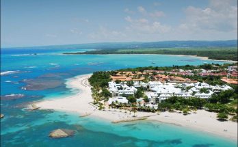
The Virgin Islands are the western island group of the Leeward Islands, which are the northern part of the Lesser Antilles, and form the border between the Caribbean Sea and the Atlantic Ocean. Politically, the eastern islands form the British Virgin Islands and the western ones form the United States Virgin Islands. The British Virgin Islands is an Overseas Territory of the United Kingdom comprising approximately 60 islands and cays including Tortola, Virgin Gorda, Jost Van Dyke, and Anegada.
The U.S. Virgin Islands is one of five inhabited insular areas of the United States, along with American Samoa, Guam, Northern Mariana Islands, and Puerto Rico. The territory comprises a number of islands including St. Croix, St. Thomas and Water Island.
The Virgin Passage separates the American Virgin Islands from the so-called Spanish Virgin Islands of Vieques and Culebra, which are part of Puerto Rico. The United States dollar is the official currency on both the British and American Virgin Islands as well as the Spanish/Puerto Rican Virgin Islands.
The Virgin Islands were originally inhabited by the Arawak, Carib, and Cermic, all of whom are thought to have perished during the colonial period due to enslavement, foreign disease, and mass extermination[citation needed] brought by European colonists.
European colonists later settled here and established sugar plantations, at least one tobacco plantation, and purchased slaves acquired from Africa. The plantations are gone, but the descendants of the slaves remain the bulk of the population, sharing a common African-Caribbean heritage with the rest of the English-speaking Caribbean.
In 1916 and 1917, Denmark and the U.S., respectively, ratified a treaty in which Denmark sold the Danish West Indies to the United States of America for $25 million in gold.
In the 1990s a Puerto Rican tourism campaign renamed the Passage Islands as the Spanish Virgin Islands,[citation needed] though they are seldom[clarification needed] identified as such on maps and atlases.[citation needed] They are part of the Commonwealth of Puerto Rico, located east of the main island of Puerto Rico. They are closer to St. Thomas than St. Thomas is to St. Croix.
Visits: 69