The town of Asyut marks the northern end of the Nile ravine. From there on for the 215 miles (346 km.) to the head of the delta the valley is in its most open section. On the west side the plateau scarp is separated from the flood plain by a vast expanse of gravel, sand, and marl nowhere more than 400 feet above sea level, except where it is broken by small limestone mesas and the low ridge shutting off the Faiyum and Rayan depressions on the east.
The scarp of the limestone plateau on the east side is not only low (600 to 700 feet high) but is broken by many wadi mouths. Although much closer to the flood plain of the river than the western scarp, the eastern scarp stands for the most part 10 to 15 miles from it. Only as Cairo is approached is it to be seen rising nearer the river.
For the 150 miles (241 km.) between Asyut and the town of Beni Suef the flood plain averages 12 to 13 miles wide and in places reaches 15 miles. All of it is on the west side of the river; on the east side, between the high Nile embankment and the foothills at the base of the limestone plateau, occurs only a stretch of barren gravel. The flood plain here is the most extensively and effectively irrigated of any section of the Nile valley. It contains more than a third of the cultivated land of the valley, all under perennial irrigation, with cotton, corn, and wheat the leading crops.
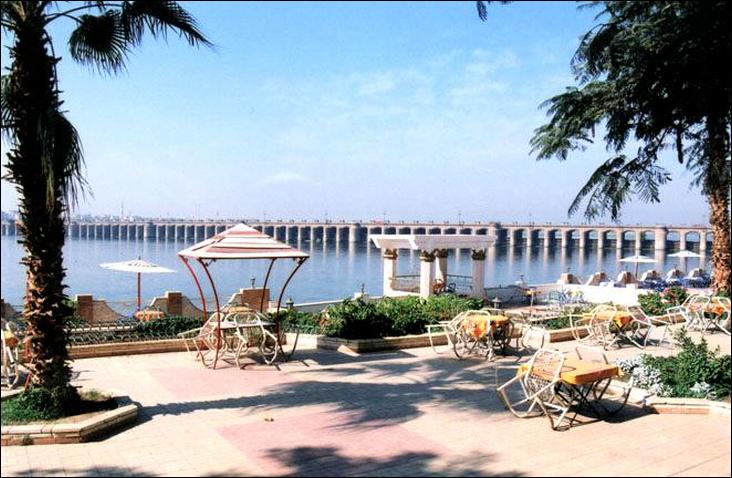
The Ibrahimiya Canal, which waters it, is Egypt’s largest irrigation canal nearly 200 feet wide for most of its length and 195 miles (314 km.) long from where it leaves the Nile above the Asyut Barrage to Aiyat, where it empties its surplus water into the Giza Canal. The Asyut Barrage, completed in 1902 just below the town of Asyut, was built to maintain water level at sufficient height to keep it in full supply during the summer lowwater period of the Nile.
Here, as in the Nile ravine, a large number of good-sized towns lie within a few miles of each other. El Minya and Beni Suef, capitals, respectively, of the provinces of the same names, and Mallawi (in Asyut province, are the chief towns; there are five others. Cotton ginning, flour milling, and other processing of agricultural products are the principal industries.
Immediately north of Beni Suef the valley begins to narrow, and from El Wasta, 18 miles below Beni Suef, to Cairo, 50 miles beyond, it averages only 5 miles wide. The river widens here and meanders in the middle of the flood plain, with the cultivated land of about equal width on either side. On the east side the escarpment of the limestone plateau begins to encroach on the valley; at Helwan, 15 miles south of Cairo, its 700-foot cliffs stand only 8 miles from the river, and at Tura, 8 miles farther north, they are only 2.5 miles from it. On the west the broad plain is a rolling terrain of gravel and sand averaging 400 feet above the sea.
This section of the valley thrives with activities catering to the Cairo-Giza metropolis. Orchards and truck, dairy, and poultry farms figure largely in agricultural land use. Motor roads and railroad afford close contact with the city markets, and the barges and sailboats loaded with the agricultural products and manufactures of the valley throng the Nile. Helwan, a few miles east of the narrow fringe of cultivated land and close to the limestone escarpment, owes its settlement to the occurrence of numerous mineral springs in the vicinity. These and the dryness and purity of its air have made it a famed health resort. Between Helwan and Cairo is an almost continuous chain of manufacturing establishments, which are gradually invading Helwan itself, where the government proposes to build an iron and steel plant using ore from the Aswan deposits.
The importance of this section of the Nile valley as the gateway between the valley and the delta has been recognized since ancient times. From this strategic position the early dynasties united and held the valley and delta as a single kingdom. The remains of Memphis, the first capital of united Egypt, are now a barren mound on the desert west of the Nile, 10 miles south of Giza. The choice by the Arab conquerors of various sites around Cairo and finally of Cairo itself for their capitals reflects the military, administrative and economic importance of this gateway.
Visits: 41