As in the Maritime Provinces, it has been shown that there are three main levels of peneplanation in Quebec. The lowest, called the Quebec Platform lies in the St. Lawrence Lowlands. It was fashioned by the pre-glacial network of rivers. It is well developed around Montreal, being some 70 miles in width between the Laurentian plateau and the Appalachians. It is very low, ranging from 100′ to less than 300′ above sea level.
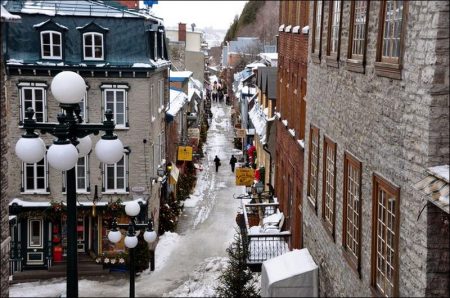
Towards Quebec City, the platform is narrower and seems to be pinched between the edge of the Canadian Shield and the Appalachians. The Upper City is built on a fragment of that platform about 300 feet high. It is thought to be a Pliocene peneplain, achieved toward the end of the Tertiary Era. This erosion level is also found along the Ottawa River as far as Hull, along the South shore of the Estuary, as far as Matane, and along the Baie de Chaleur. The best farmlands were first settled on this peneplain, and its low relief is favourable to transportation.
The second level of erosion is the Appalachian Platform. Its altitude varies from about 700 to 1,300 feet. It is evident in the fairly uniform level in Gaspé peninsula except in the central part, on the South Shore of the Estuary, above the escarpment facing the shoreline, and is widespread in the Eastern Townships except for the summits of ranges. The same platform exists on a much larger scale in the Laurentian Upland. The peneplain was carved during the Miocene and Oligocene periods. Much of it is still covered with forest, but some parts are settled, as in the Eastern Townships, in Central Laurentians, in Western Quebec and elsewhere.
The third level of erosion, called the Shickshock Platform by Blanchard, rises above 2,000 feet. Only a few fragments of that oldest landform remain. They are located in Central Gaspé, in a few summits in the Eastern Townships, in the Laurentide National Park, around Mont-Tremblant, and within the Canadian Shield, north of the Saguenay. Since it dates back to the Eocene and perhaps even to the Upper Cretaceous Period, it is found in most places to be a dissected and broken country, as in the Shickshocks and in the Laurentide Park. But the skyline is nevertheless fairly level. These wooded hills and plateaus have, for the most part, been set aside as forest preserves.
Drainage
The whole area of Quebec is drained, either directly or indirectly into the Atlantic Ocean. There are two main watersheds: (a) The St. Lawrence River and Gulf, and (b) Hudson Bay. The former is the most important on account of its location in the settled part of the Province.
Visits: 66


